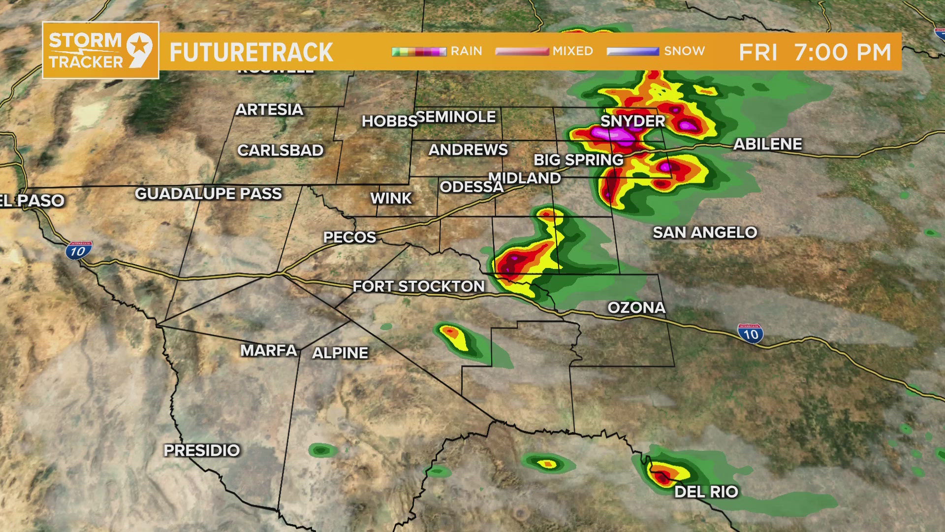
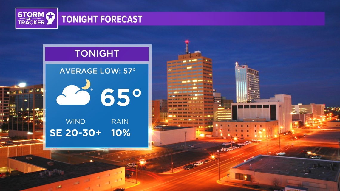
TONIGHT: An upper trough over Southern California is helping to maintain southwesterly winds in the atmosphere above West Texas. The dryline extending over the area keeps moisture levels high alongside increased instability. Deep-layer shear increases through the afternoon and into the night, enhancing the supercell threat along the dryline and last night's boundary. A strong Jetstream overnight and cloud cover will keep lows above normal.
LOW: 65°
WIND: SE 20-30+ mph.

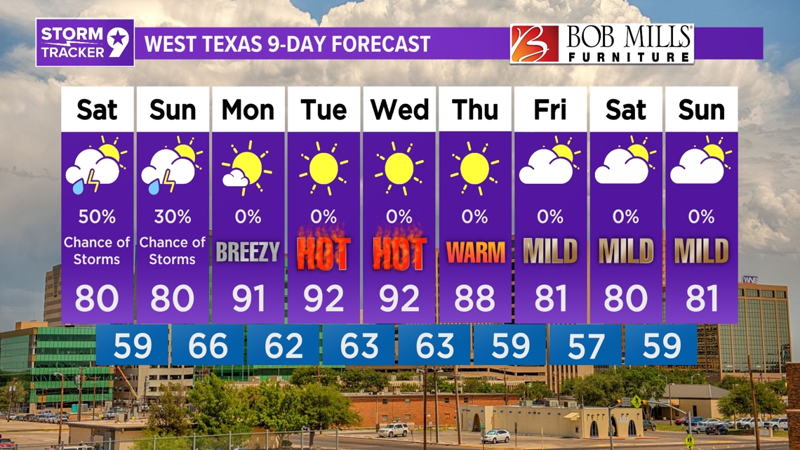
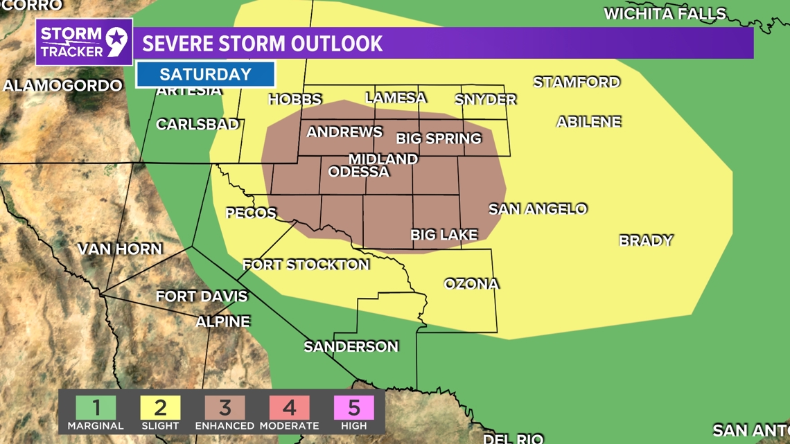
TOMORROW: On Saturday, the west coast trough moves eastward, with a boundary from overnight convection shifting the dryline to the western border. Deep-layer shear increases, fostering earlier and more widespread convection, with a chance of relief for some drought-stricken areas west of the Pecos. However, lightning-induced fire starts are a concern. Cooler temperatures are expected with highs around normal, and the activity may persist into Saturday night, potentially transitioning into a heavy rain scenario.
HIGH: 80°
WIND: SE 10-15 mph.

IN COMING DAYS: After an active Saturday, Sunday sees a quieting down with lingering thunderstorms weakening and sliding southeastward through the morning. Cloud cover and a worked-over atmosphere may limit further thunderstorm activity, resulting in slightly cooler temperatures but still reaching upper 70s to 80s across most areas. Scattered thunderstorms are still possible, mainly across the eastern third of the region, fueled by daytime heating along and east of the dryline. Overnight, temperatures remain mild as the dryline moves back westward, bringing in higher dewpoints. By Monday, a large trough lifts into the central and northern Great Plains, pushing the dryline eastward, leading to warm and dry conditions with temperatures quickly climbing back into the 90s. Nights remain warm but less humid, particularly further west behind the dryline. Tuesday and Wednesday follow a similar pattern with slowly warming temperatures under westerly flow. Towards the end of the week, a large trough axis may bring a cold front through the area, potentially cooling temperatures, especially by Friday. However, little moisture is expected behind the front, suggesting a dry outlook for the rest of the week.

Sunday: 30% chance for showers and mostly cloudy with highs near 80°.
Monday: Mostly sunny with highs near 91°.
Tuesday: Sunny with highs near 92°.
Wednesday: Sunny with highs near 92°.
Thursday: Sunny with highs near 88°.
Friday: Partly cloudy with highs near 81°.
Saturday: Partly cloudy with highs near 80°.
Sunday: Partly cloudy with highs near 81°.