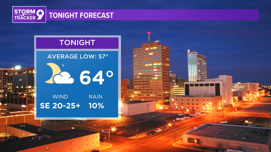
TONIGHT: Strong and severe thunderstorms are expected to develop in the same timeline as we saw the ones yesterday., All of these will be associated with the dryline that has been giving us active weather over the last few days. We will likely see a supercell develop around Pecos which will then spin off a number of storms along the dryline that push their way northward into the Permian Basin. The SPC has the eastern counties under a Level 3 Enhanced risk, meaning all forms of severe weather will be possible from hail to wind and tornadoes. Make sure you have multiple forms to receive weather alerts when this happens. Most storms will leave by 9pm leaving us warm and humid throughout the overnight hours.
LOW: 64°
WIND: SE 20-25+ mph.

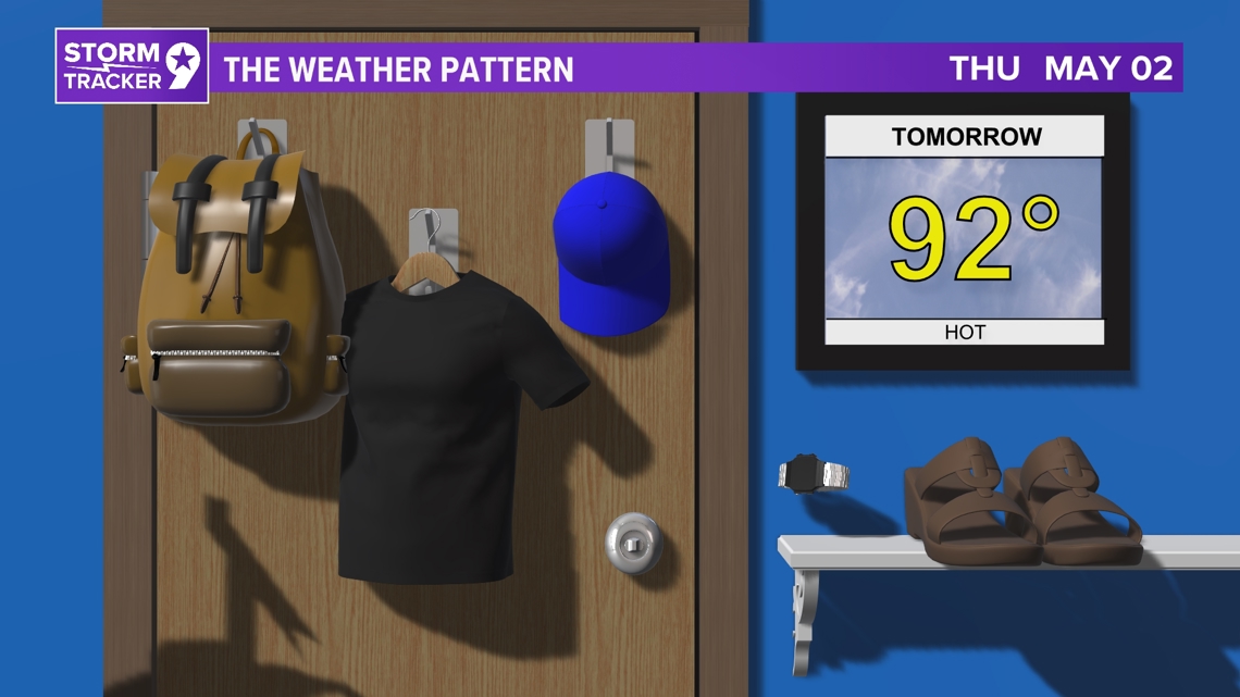
TOMORROW: Wild weather looks to hold off for a bit as our next cold front tries to push into West Texas. Given the strong heating expected during the day, it will likely stall to the north and reintroduce the westerly winds by the afternoon. This will get the dryline out of our region and leave us with very low relative humidity values. Increase fire risk and Red Flag Warnings are expected to follow as a result. Temperatures are expected to come in about 5-7 degrees above average.
HIGH: 92°
WIND: SW 10-15 mph.

IN COMING DAYS: The end of this week marks the beginning of more active weather across the region. A large upper-low over southern Manitoba and Ontario, along with a southern California trough, will bring southwesterly flow aloft over the southern Great Plains. A cold front may approach northern areas, bringing a chance of thunderstorms, while temperatures remain warm in the 80s and 90s. The weekend sees a broadening trough moving into the central Great Plains, likely resulting in widespread thunderstorm development, with heavy rainfall as the main concern. Cooler temperatures in the 70s and 80s are expected due to the cold front. By the new week, drier and warmer weather returns as ridging builds over the southern Great Plains, with temperatures climbing back into the 80s and 90s by Tuesday and Wednesday.

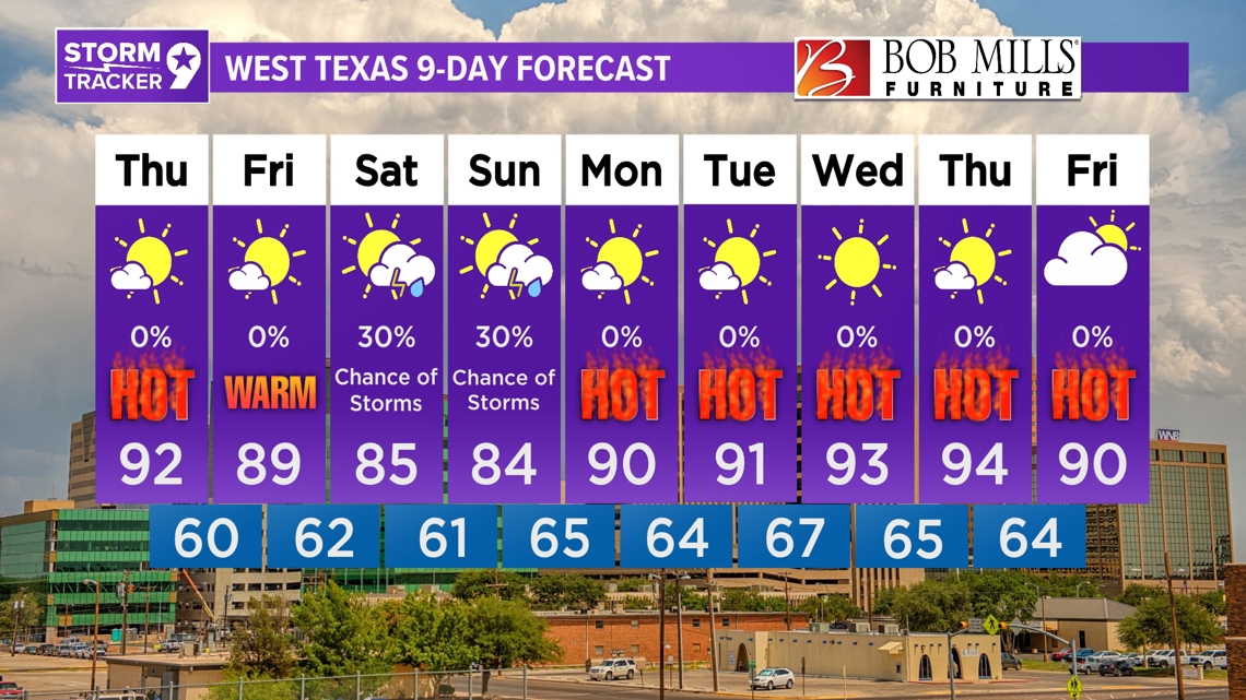
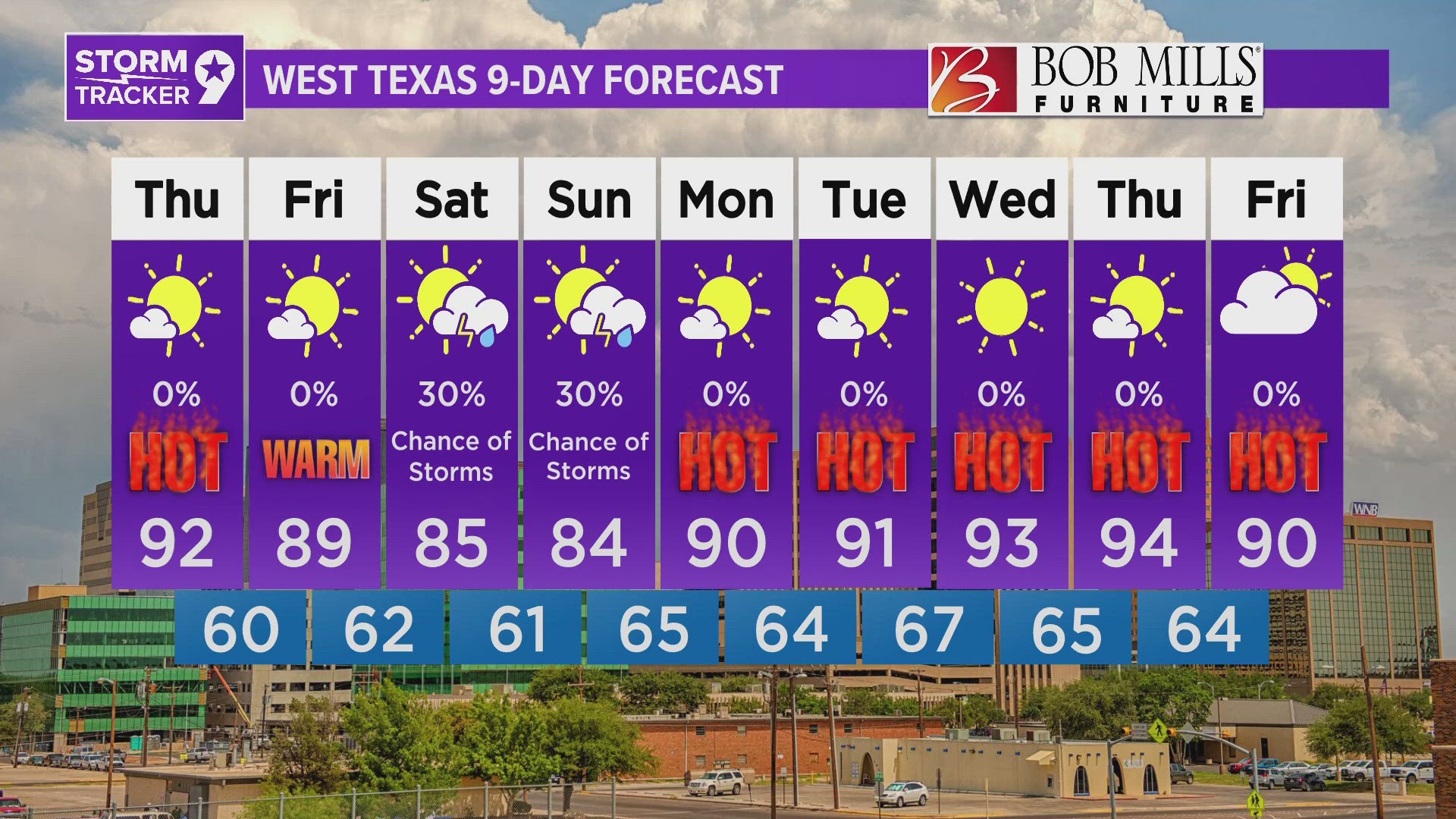
Friday: Mostly sunny with highs near 89°.
Saturday: 30% chance for showers and partly cloudy with highs near 85°.
Sunday: 30% chance for showers and partly cloudy with highs near 84°.
Monday: Mostly sunny with highs near 90°.
Tuesday: Mostly sunny with highs near 91°.
Wednesday: Sunny with highs near 93°.
Thursday: Mostly sunny with highs near 94°.
Friday: Partly cloudy with highs near 90°.